5W and H Questions for Restore Pinga Oya

Why and Where

Sri Lanka, like the rest of Asia, is organizing rapidly in particular peri-urban (surrounding urban centers) that are changing without overall spatial planning (town planning). Pinga Oya catchment is a prime example of such a peri-urban urbanizing region spanning Katugastota, Akurana, Ambatenne, and Alawatugoda. This led to frequent undue flooding leading to the rapid spread of infectious diseases rise in floods and landslides disasters while leading to less of natural habitats including in the river. There is much information that is available but not accessible and information that is not readily available and there are knowledge gaps. Our work is to address these issues.

ශ්‍රී ලංකාව ආසියානු කලාපයේ සෙසු රටවල මෙන් නාගරික ප්‍රදේශ කේන්ද්‍ර කරගනිමින් විධිමත් නගර සැලසුම් නොමැතිව ශීඝ්‍රයෙන් නාගරීකරණයට ලක්වෙමින් පවතී. පිඟාඔය ජල පෝෂක කලාපය මේ සදහා එක් නිදසුනක් වන අතර කටුගස්තොට, අකුරණ, අඹතැන්න සහ අලවතුගොඩ යන උප නගරවල විහිද පවතී. මේ නිසා ඒ ආශ්‍රිතව ඇතිවන ක්‍ෂණික ගංවතුර තත්ත්වයන් හේතුවෙන් බෝවන රෝග සීඝ්‍රයෙන් ව්‍යාප්ත වීම සහ හදිසි නායයාම් තත්ත්වයන්ට මුහුණ දීම ද සිදුවන අතර පිඟාඔය අවට ස්වභාවික පරිසර පද්ධතිය අඩුවීමට ද හේතු වේ. මේ සම්බන්ධව බොහෝ තොරතුරු ඇති නමුත් පහසුවෙන් පිවිසිය නොහැකි වීම, ඇතැම් කරුණු පිලිබද නිසි අවබොධයක් නොමැති වීම සහ දැනුම් පරතරය පැවතීම යනාදී ගැටළු ඇත. අපගේ කාර්යය වනුයේ මෙම සම්බන්ධයෙන් පවතින ගැටළු පිළිබදව ඔබව දැනුවත් කිරීමයි.


இலங்கை, ஆசியாவின் பிறபகுதிகளைப்போலவே குறிப்பாக புற நகர்ப்புற பகுதிகள் எந்த வித இடம் சார்ந்த திட்டமிடலும் இன்றி மாற்றத்திற்கு உட்பட்டு வருகின்றது. கட்டுகஸ்தோட்டை, அக்குரணை, அம்பத்தென்னை, அலவத்துகொடை போன்ற பிரதேசங்களில் உள்ளடங்கும் பிங்கா ஓயா நீர்ப்பிடிப்பானது இது போன்ற நகரமயமாக்கல் பகுதிக்கு ஓர் பிரதான உதாரணம் ஆகும்.இது அடிக்கடி நிலவும் வெள்ளப்பெருக்கிற்கு வழிவகுப்பதோடு, மற்றும் வெள்ளப்பெருக்கு, நிலச்சரிவு என்பவற்றின் போது பரவும் தொற்று நோய்களையும் அதிகரிக்கின்றது. அதே நேரம் இது ஆற்றில் வாழும் இயற்கை வாழ்விடங்களின் வீழ்ச்சிக்கும் காரணமாய் அமைகின்றது. இருப்பினும் பல தகவல்கள் இது பற்றி இருந்தாலும், அவை அணுக முடியாத முறையிலும் பெற்றுக்கொள்வதில் தாமதம் ஏற்படுத்தும் வகையிலும் உள்ளன. இவ்வாறாக நிலவும் பிரச்சனைகளை தீ்ர்ப்பதே இங்கு எமது நோக்கமாக கருதப்படுகிறது.

Who

This website is intended to aid those affected by environmental mismanagement and disaster, the concerned and the youth to be better informed of the scientific background behind the disasters and to better understand the governance and its shortcomings. This work is being done by persons and organizations who have in-depth knowledge over the last four decades. Our team comprises individuals and organizations concerned with the environment, climate, disasters, and social welfare of women and children. It is supported by a team of younger social and environmental and engineering researchers and ICT technology experts. Individual researchers from several Universities such as Peradeniya, Colombo, Open University of Sri Lanka, Southeastern, and Columbia University of New York are contributing.

මෙම වෙබ් අඩවියේ අරමුණ වනුයේ ස්වාභාවික ආපදා තත්වයන් හේතුවෙන් විපතට පත් වූවන්ට උපකාර කිරීම, ආපදා තත්වයන්ට අදාළ විද්‍යාත්මක පසුබිම පිළිබඳව තරුණ ප්‍රජාව දැනුවත් කිරීම සහ එහි පවතින අඩුපාඩු, පාලනවිධි සම්බන්ධව නිසිලෙස අවබෝධ කර ගැනීමයි. මෙය පසුගිය දශක හතරක කාලය තුළ පුළුල් දැනුමක් සහ අත්දැකිම් ලබා ඇති පුද්ගලයින් සහ සංවිධානවල සහභාගිත්වයෙන් සිදු කරනු ලැබේ. අපගේ කණ්ඩායම පරිසර, දේශගුණ, ආපදා සහ සමාජ සුබසාධන කටයුතු සම්බන්ධ පුද්ගලයින් සහ සංවිධාන වලින් සමන්විත වේ. මේ සදහා තරුණ සමාජ, පාරිසරික සහ ඉංජිනේරු පර්යේෂකයන් සහ තොරතුරු හා සන්නිවේදන තාක්ෂණ විශේෂඥයින්ගෙන් සමන්විත කණ්ඩායමක් සහාය දක්වයි. තවද පේරාදෙණිය විශ්වවිද්‍යාලය, කොළඹ විශ්වවිද්‍යාලය, ශ්‍රී ලංකා විවෘත විශ්වවිද්‍යාලය, අග්නිදිග විශ්වවිද්‍යාලය සහ නිව්යෝක්හි කොලොම්බියා විශ්වවිද්‍යාලයන් ද දායකත්වය ලබාදෙයි.


இந்த தளமானது பாதிக்கப்பட்டவர்கள், சம்பந்தப்பட்டவர்கள் மற்றும் இளைஞர்கள் என அனைவரும், அனர்ததங்களுக்கு பின்னால் உள்ள அறிவியல் பின்னணியையும், நிர்வாகம் மற்றும் அதன் குறைபாடுகளையும் புரிந்துகொள்ள வேண்டும் என்பதை நோக்கமாக கொண்டுள்ளது. கடந்த நான்கு தசாப்தங்களாக இது தொடர்பான அனுபவம் மற்றும் அறிவை கொண்ட தனிநபர்களாலும் நிறுவனங்களாலும் இந்த பணி தொடர்கிறது. இந்த அமைப்பு முற்றிலும் மதம், கட்சி, அரசியல் சார்ப்பற்றதோடு எந்தவொரு குறிப்பிட்ட அரசுடனோ அல்லது அதிகாரிகளுடனோ இணைக்கப்படவில்லை. மேலும் சுற்றுச்சூழல் மற்றும் பொறியியல் ஆராய்ச்சியாளர்கள், ICT தொழில்நுட்ப வல்லுநர்கள் போன்றோரின் பாரிய பங்களிப்பை கொண்டுள்ளதொடு, பேராதனை, கொழும்பு, இலங்கை திறந்த பல்கலைக்கழகம், தென்கிழக்கு மற்றும் நியூயோர்க்கின் கொலம்பியா பல்கலைக்கழகம் போன்ற பல பல்கலைக்கழகங்களின் தனிப்பட்ட ஆய்வாளர்களும் பங்களிக்கின்றனர்.

What

This website shall be used to provide a portal for information on environmental and social issues in the Pinga Oya basin. We also seek to identify the gaps in knowledge that are holding back an informed citizenry and advocacy. We shall proceed to provide reliable information to aid advocacy efforts and provide educational materials.

පිඟාඔය ආශ්‍රිතව පවතින පාරිසරික හා සමාජීය ගැටලු පිළිබඳ තොරතුරු සැපයිම සඳහා පිවිසුමක් ලෙස මෙම වෙබ් අඩවිය භාවිතා කළ හැකිය. මෙමගින් දැනුම් හිඩැස් හඳුනා ගැනීමට සහ ඒ සම්බන්ධයෙන් මහජනතාව දැනුවත් කිරීම සදහා අප උත්සාහ දරනෙමු. තවද විශ්වාසදායක තොරතුරු සැපයීම මගින් උපදේශන ප්‍රයත්නයන්ට අදාළව සහය වීමට සහ ඊට අදාළ අධ්‍යාපනික තොරතුරු සැපයීමට ද අපි කටයුතු කරමු.

இந்த வளைத்தளமானது பிங்கா ஓயா ஆற்றுப்படுக்கை தொடர்பான சமூகம் மற்றும் சூழல் சார்ந்த பிரச்சனைகள் பற்றிய தகவல்களை வழங்கும் நோக்குடனும் ஆரம்பிக்கப்பட்டுள்ளது. மக்களிடையே நிலவும் இது பற்றிய தெளிவற்ற சிந்தனைகளை கண்டறிந்து அவற்றை தெளிவூட்டும் வகையில் செயற்படுவதையும் நோக்கமாக கொண்டுள்ளது. அத்தோடு நம்பகத்தன்மையான தகவல்களை பகிர்தல் மூலம் இது பற்றிய அக்கறை கொண்டவர்களது செயல்களுக்கும் ஆதரவு வழங்கவுள்ளோம்.

How

We are setting up a communication network on these topics as well, and welcome News articles and multimedia content. Associated with social media channels for Twitter, Facebook, WhatsApp, Instagram, and YouTube. We seek your support to build our Followers and Subscriptions as that shall strengthen our hand in terms of accessing resources.

අප විසින් ඔබව දැනුවත් කිරීම සදහා සන්නිවේදන ජාලයක් පිහිටුවා ඇති අතර ඊට පුවත්පත් ලිපි සහ බහුමාධ්‍ය අන්තර්ගතයන් ද අදාළ වේ. එය Twitter, Facebook, WhatsApp, Instagram සහ YouTube යන සමාජ මාධ්‍ය ජාල වලින් සමන්විත වේ. මෙම කර්තව්‍ය සාර්ථකව පවත්වාගෙන යාම සහ දායකත්වයන් ගොඩනගා ගැනීමට අප ඔබගේ නිරන්තර සහය අපේක්ෂා කරමු.


இது பற்றிய கலந்துரையாடல்களை மேற்கொள்வதற்கும், தகவல்களை பகிர்வதற்கும் தற்போது நாம் தொடர்பாடல் வலையமைப்புக்களை நிறுவிக்கொண்டு வருகிறோம். Twitter, Facebook, WhatsApp, Instagram மற்றும் YouTube என்பவற்றை உயிர்ப்போடு, தொடர்ந்து செயற்படுத்துவதற்கு உங்கள் ஆதரவு அவசியமானதாகும்.

Restore Pinga Oya

Restore Pinga Oya

#RestorePingaOya is a multi-platform digital portal to make available reliable information to support evidence-based discussions on the Pinga Oya tributary of the Mahaweli and its catchment, and relevant activity of government and private actors so as to support advocacy to better its governance. Our focus is on highly disturbed portions of the river such as in Akurana.

There were three floods in Akurana in the 2nd half of 2022 in August, September and December 25. The flood level raised upto 9.5 feet above the road level at its deepest at the Dunuwilla road intersection. The spatial extent of the floods was expanded. Initial estimates for the flood damage was 980 million rupees but this shall be an underestimate.

The #RestorePingaOya initiative is an effort to make the water body what is used to be, a helpful resource to everyone in the vicinity.

Enhancing the climate literacy among the youth in Sri Lanka

Disaster

Promoting Literacy on Climate, Climate Change, its Impacts and Mitigation through Awareness of Potential Transition to High Renewable Energy in Sri Lanka

Purpose of the project

In order to provide basic localized information on climate change, its impacts authoritatively so as to support youth action and understanding and to reach four selected climate impacted and vulnerable communities Disaster Service Centre launched a project with the British High Commission of Sri Lanka on December 2020 . We targeted the youth (via social media users) audience primarily, and community based organizations, institutions, local leaders in climate impacted and vulnerable locales. The targeted locations are in the Central, North-Western, and Sabaragamuwa Province with impacts on disasters, ecosystem services and disease risk (dengue, TB) and to build awareness of the global renewable energy transition, and the potential in Sri Lanka to transition to a high renewable future (80% by 2030 as proposed by National Policy Framework). We specifically targeted the local engineering fraternity (energy-focused), supporters of renewable energy, decision-makers, and young people. This information will assist in fostering the conditions necessary for public demand for a focus on renewable energy in national action plans.

Project Summary

Climate Change, Impacts and Adaptation Component

While there is awareness of global climate change among Sri Lankans, the response of youth and community is held back by,

•the lack of awareness of local climate change based on state of the art research ,
•the lack of understanding of the regional, seasonal, and longer-term changes in climate,
•the lack of awareness of evidence to attribute impacts of climate change locally (e.g. on disasters, ecosystem services, and infectious and respiratory diseases).

Renewable Energy Transition Component

We have identified a gap in the knowledge about the global renewable centric energy transition among many Sri Lankans. This is evident in multiple SM platforms in Sri Lanka related to the sector. Among wider public and youth, this knowledge is even sparser, and is supported by active disinformation by fossil fuel interests. This is in spite of Sri Lanka being uniquely suited for the transition due to its potential and high hydropower installations. Within the project we will make content regarding global renewable shift, address myths about ‘difficulty of RE integration’ opportunities RE presents to Sri Lanka in economic, social and environmental spheres

Social Media Promotion

Facebook, Instagram, YouTube, WhatsApp and Twitter are platforms used to disseminate the output and assess the social media outreach.
Facebook and Twitter platforms were being uploaded with the content being careful to upload only a few at a time and the outreach is yet to be assessed.
As the first step we listed down the existing social media groups that we intended to disseminate the outputs. Then we looked at the new climate and disaster related groups where we can distribute our content with creative hashtags and background descriptions. A schedule was prepared to share the content and assess the reach by a responsible person. FECT’s official WhatsApp account has lately been set up to share the outputs by being a member of climate and disaster related groups.


Outputs

In terms of accessibility and understandability we employed PowerPoint as the tool to create brochures, factsheets and posters. 10 infographics were designed using Canva as it helps in Real-time collaboration across the team members.
Throughout the video production process, several tools were used. At first we made the decision to prepare the video using Powtoon since it enables frame creating, audio narration, video editing and merging audio with video which is expensive and didn’t addressed our needs. But lately we found that in each stage we can use separate tools to complete storyboarding, frame creating, Initially Video frames were created using PowerPoint. Audacity was used to edit the audio file of the video. In the third step, Fillmora was used to merge audio narration and PowerPoint frames together and continued the video editing process.

Air Quality TechCamp in Kathmandu

Sri Lankan Participants in TechCamp, Kathmandu


Clean Air for South Asia Techcamp in Kathmandu

The U.S. Embassy in Nepal, in partnership with Kathmandu Living Labs, organized a two-day South Asia Air Quality Tech Camp on July 30-31st.

U.S. Embassy in Nepal, in partnership with Kathmandu Living Labs, organized a two-day South Asia Air Quality TechCamp on July 30-31st, accompanied with world-class trainers and 60 participants from seven South Asian countries: Nepal, Sri Lanka, Bangladesh, Bhutan, India, Maldives and Pakistan.

Sri Lankan Participants in TechCamp, Kathmandu
Photo: US Embassy Kathmandu/Flickr

The aim of the camp was to address political, social, and scientific facets of the problem and improve the ability of civil society, media, and other influencers to engage governments, empower the public and take action to improve air quality in South Asia.


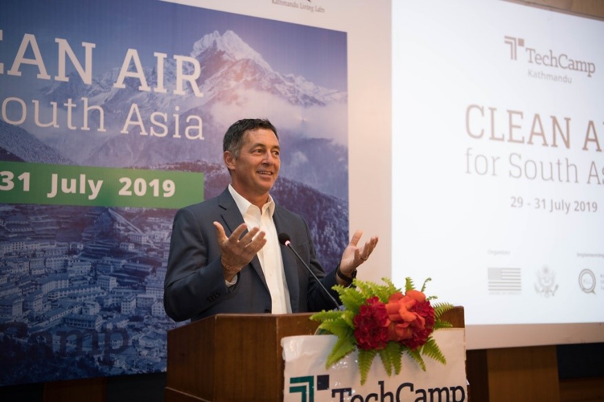
US Ambassador to Nepal, H.E. Randy W. Berry

“Air pollution does not respect national boundaries,” US Ambassador to Nepal, H.E. Randy W. Berry pointed out the regional cooperation required to solve the issue of air pollution.

Photo: US Embassy Kathmandu/Flickr


Participants and trainers from 10+ countries selected topics under, What’s the biggest challenge you face in your work on air quality?

  • Reliable Data/Access to Data
  • Regulations/Enforcement of Existing Regulations
  • Proper Monitoring Systems or Collection of Data
  • Awareness/Targeting the Right Audience
  • Coordination: Among Stakeholders or Across Borders
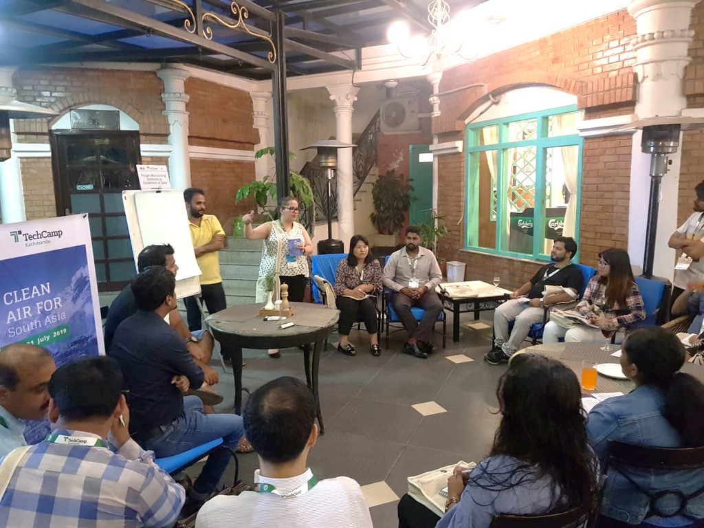
Proper Monitoring Systems/Collection of Data – Group Discussion
Proper Monitoring Systems/Collection of Data – Group Discussion Facilitators: Neelam Azmat, Santosh Gartaula
Photo: Kathmandu Living Labs

We selected one topic with a challenge we identified in our work and dived into the first round of discussions. In Sri Lanka, we have monitoring systems based on BAM and Low-Cost Sensors. But we need to have a proper monitoring network combining the region.

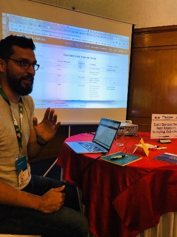
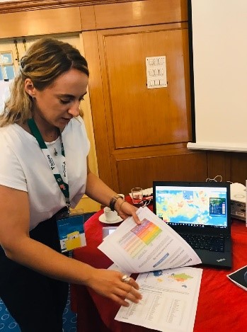
Speed Geeking

We spent five minutes with each trainer in 14 small groups. The trainers shared their stories of using a particular technology/strategy to address air pollution.

Photos: Piushani Ellegala

Author: Ms Piushani Ellegala

Dealing with disasters

Dealing with disasters

Sri Lanka braces itself for yet another round of floods; the third in as many years. As floods and droughts become regular occurrences, how should the nation respond?
The impact of this year’s floods is not yet known but likely to be heavy. In May 2017 floods and landslides affected 15 of the 25 districts of Sri Lanka. The drought in 2016 and 2017 affected 1,927,069 people across 17 districts, many of them poor.
“Approximately 12 per cent of those affected were poor, nearly twice the national average of 6.7 per cent. In the case of the landslides, this is because the 11 affected Divisional Secretary (DS) Divisions tend to be poorer than the national average. Those affected by the floods overall were also disproportionately poor, with an estimated poverty rate of 8.7 per cent.” (World Bank)
If the poor are disproportionately affected by natural disasters it has a negative impact on poverty and therefore has the highest level of priority for policymakers.
Little can be done about the weather but proper risk management can minimize its impact. The Government needs to move from the unplanned and ad-hoc reaction when disaster strikes to a proactive, systematic management of risk, something that may be illustrated by the example of Chile.
The earthquake that rocked Chile in 2010, one of the largest in history that wiped out roughly 18% of the country’s GDP – a massive impact. (The impact Sri Lanka’s 2017 floods was only 0.4% of GDP.) Yet Chile demonstrated a miraculous recovery. Most countries that suffer catastrophes of that magnitude take years or even decades to recover. Chile did it quickly, how did it do so?
Several factors contributed overall to the low casualty rate and rapid recovery.
The Government had decided to priorities the role it played in managing disasters. First, in minimizing damage, because of its history with natural disasters, Chile’s Government had developed a strong building code and ensured it was properly enforced. In particular, Chile had a law that held building owners accountable for losses in a building they built for 10 years. Furthermore, while not legally required, almost all homeowners in Chile had earthquake insurance because banks required it in order to get a loan to buy a house.
Second, the disaster response had been well-planned- the number of fires after the earthquake was limited due to the immediate shut down the electricity grid and the local emergency response was very effective. The third factor was education: the overall high level of knowledge about earthquakes and tsunamis by much of the population that helped them respond more appropriately after the event.
After the disaster, any government faces the question of how reconstruction will be paid for. Did Chile wait for aid to arrive? No.
Following the quake, because of the sheer size of the disaster, Chile was compelled to increase taxes temporarily. But the policies that ensured that a large part of the homeowner market was insured paid off – it minimized the amount the Government needed to finance. Together these contained the financial ramifications from the earthquake and put Chile quickly on the road to recovery.
Although Sri Lanka never experienced anything like the devastation in Chile, natural disasters in Sri Lanka take a heavy toll on resources and people. Apart from the human cost they disrupt agricultural output (which may affect exports) and increase food inflation. The contraction of economic activity negatively impacts government revenue while simultaneously creating new budget pressures in the form of disaster relief. In the four months of 2017, the government reportedly incurred LKR 1,397 million for the provision of disaster relief (World Bank).
How can risk be managed?
Small risks may be managed by households and slightly larger ones at the level of the community but for largest risks governments have a critical role, providing an enabling environment for shared action and responsibility and channeling direct support to vulnerable people.
The problem needs to be tackled across three fronts:
1. Preventive measures that minimize the impact of disasters.
2. Early warning systems and evacuation plans that allow people to leave disaster zones to safer areas.
3. Managing the financial risks from natural disasters.

Preventive measures

1. Floodplain zoning

A flood zoning authority must be created and floodplains (the water channel, flood channel and low land susceptible to floods) must be surveyed. The survey forms the basis of establishing floodplain zones, including delineation of the areas subject to flooding and classification of land with reference to the relative risk of flood.
Specific activities and uses (settlement and economic) in designated areas should be subject to administrative permits and building/land use codes. Eg. Building and design standards must protect against inundation. Restrictions and prohibitions should be based on risk assessments.
The public should be made aware of the dangers of floods and the need to restrict use.
Information about restrictions on construction in flood areas should be easily accessible and information about risk assessments should be easily understood, for example, clear flood maps and, where appropriate, information based on geographic information systems (GIS) should be distributed. Mandatory disclosures of risk could be included for property transfer or rental in areas of risk.

2. Conservation of wetlands

Wetlands are natural sponges that trap and slowly release surface water, rain, groundwater and flood waters. They are important in both flood and drought management so as far as possible natural wetlands and retention areas in the river basin should be conserved, and where possible restored or expanded.

3. Modifying the flood flow: Engineering measures

Diversions, reservoirs, channelization (increasing the capacity of the channel), bank protection (to prevent bank erosion), dams and floodplain restoration (creating wash lands that can safely take overflows) will play a role in minimizing impact. Engineering measures must be in harmony with the landscape and nature conservation. A holistic approach covering the whole river basin is needed as localized flood protection measures can have negative effects both downstream and upstream.

Early warning systems and education

Forecasting and early warning systems should be established and guidelines issued on how populations are to act during floods.
Education on measures that can be taken at the level of individual households to either limit the damage when flooding occurs or prevent inundation is needed, eg. elevation of structures, elevated curb stones to prevent water entry from smaller events, reinforcement of foundations to avoid structural damage, moving building contents (and particularly electrical installations) above flood water levels (either temporarily or permanently), dry flood proofing to make areas below flood water levels watertight and temporary or permanent flood walls (ranging from sandbags to free-standing concrete barriers).
Forecasts and related information must be easily accessible and real-time media coverage ensured.

Managing financial risks of natural disasters

The GoSL exposure to disaster risk is through the costs of relief/recovery, reconstruction of public assets, compensation and (re)insurance schemes that provide coverage for disasters.
Several tools are available:
i. Insurance, GoSL already has some cover with the National Insurance Trust Fund but premia can be reduced through risk reduction – eg. land-use planning, flood defenses etc. which will also support private insurance, which can top-up overall compensation.
ii. Risk pooling – insurance coverage for a pool (or its full portfolio) of Government assets. Insurance arrangements that cover a broader pool of assets facing more diversified risks can have cost advantages over insuring the assets in a flood zone.
iii. Multi-country pooling (done by several Pacific, Caribbean, African nations) provide small countries with improved access to international insurance markets based on their ability to merge a set of (less) correlated risks.
iv. Catastrophe bonds: bonds where the principal or interest payments are delayed or lost to investors in the event of a disaster.
v. Contingent credit lines with multilateral development agencies can bridge short-term shortfalls.
These are some possible options, careful assessment of the relative costs and benefits of different approaches is necessary. Once zoning is complete, the Government could lead the way in the relocation of some public assets away from areas of risk.

Rethinking agricultural policy

Agriculture is being affected by social, economic and environmental pressures. Current policies which encourage domestic agriculture need to be reviewed in the light of changing the climate, society- fewer people wish to take up agriculture, labor shortages and pressures on land use.
Policies that encourage risky production choices in flood zones or increase vulnerability to droughts and floods should be avoided. Allocation of water rights should reflect sustainable use and will help mitigate the impact of droughts. The Government must understand the impact that disasters have on poverty and recognize the proper role it must play in managing these risks. Ad-hoc responses grab headlines but working strategically to minimize long-term risks-a harder and thankless task, is the way to go.
Verified by MonsterInsights