Public Toilet built and operated by the Akurana Pradeshiya Sabhawa breaks Public Health Laws

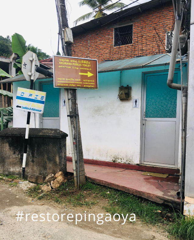
Illegal Public Toilet built and operated by the Akurana Pradeshiya Sabhawa

Floods are not the only serious hazard in Akurana and the Pinga Oya. What is not visible immediately is the biological and chemical pollution in the river. In particular, half the worst offenders in terms of building on the river margins have also built toilets illegally violating the laws about how restrictions to having toilets that can send sewage or other contamination to the river. 

That Laws that are violated (https://web.facebook.com/groups/restorepingaoya/permalink/587443209990870/

1. It is within the river margin

2. It breaks the laws regarding including toilets on the river side of the building. 

3. Its sewage disposal shall seep into the river and during times of flood the sewage shall be carried into the river. 

The DMC in its surveys in 2014 have identified it as a building in violation of reservation laws. 

Last year, a program was started by the Akurana Pradeshiya Sabhawa to identify illegal toilets and sewage disposal. Officers walked along the river downstream until the Neeralla bridge. However, their walk was stopped because the stench next to the shops there.

While there are those in the APS who take such initiative at the same time, in the last decade, the APS is not following its own rules.

There is a septic tank under the toilet which is not keeping with the laws. In addition, during floods, the contents of the toilets are washed out to the river. 
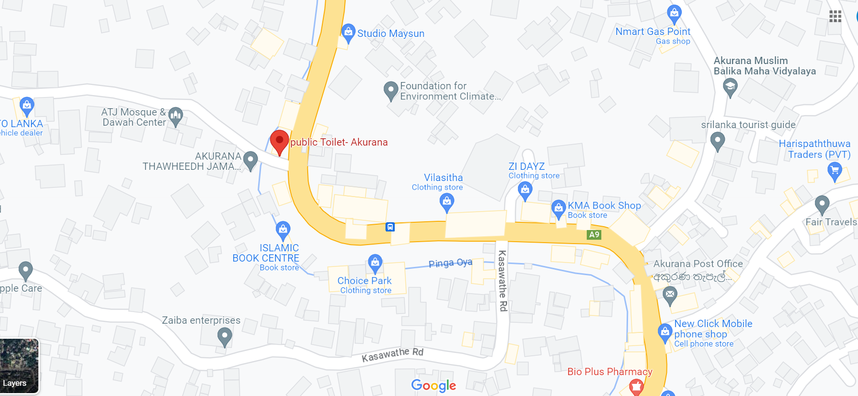
 

The location of Akurana public toilet
Front side of the toilet
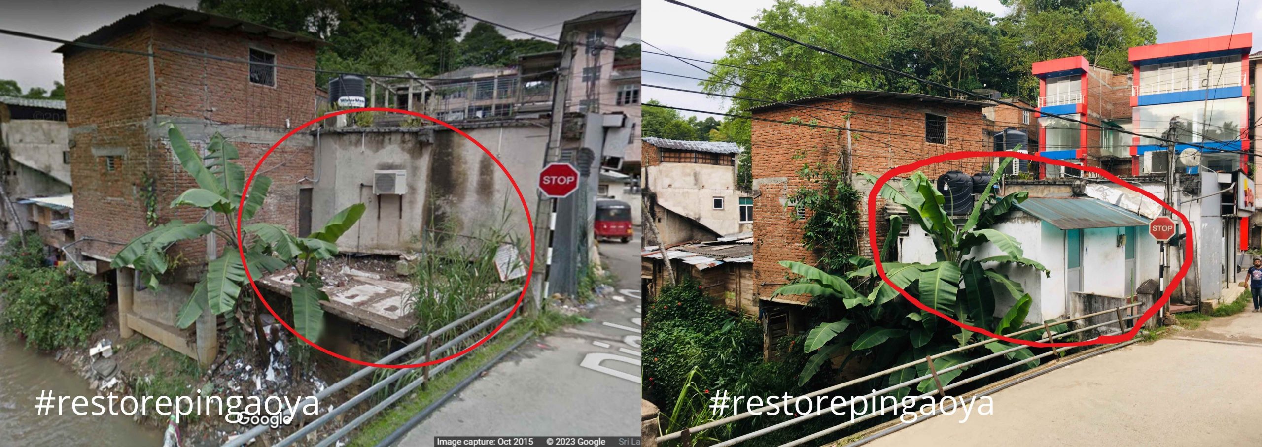
A streetview image from 2015 without the toilet and current image with toilet. 

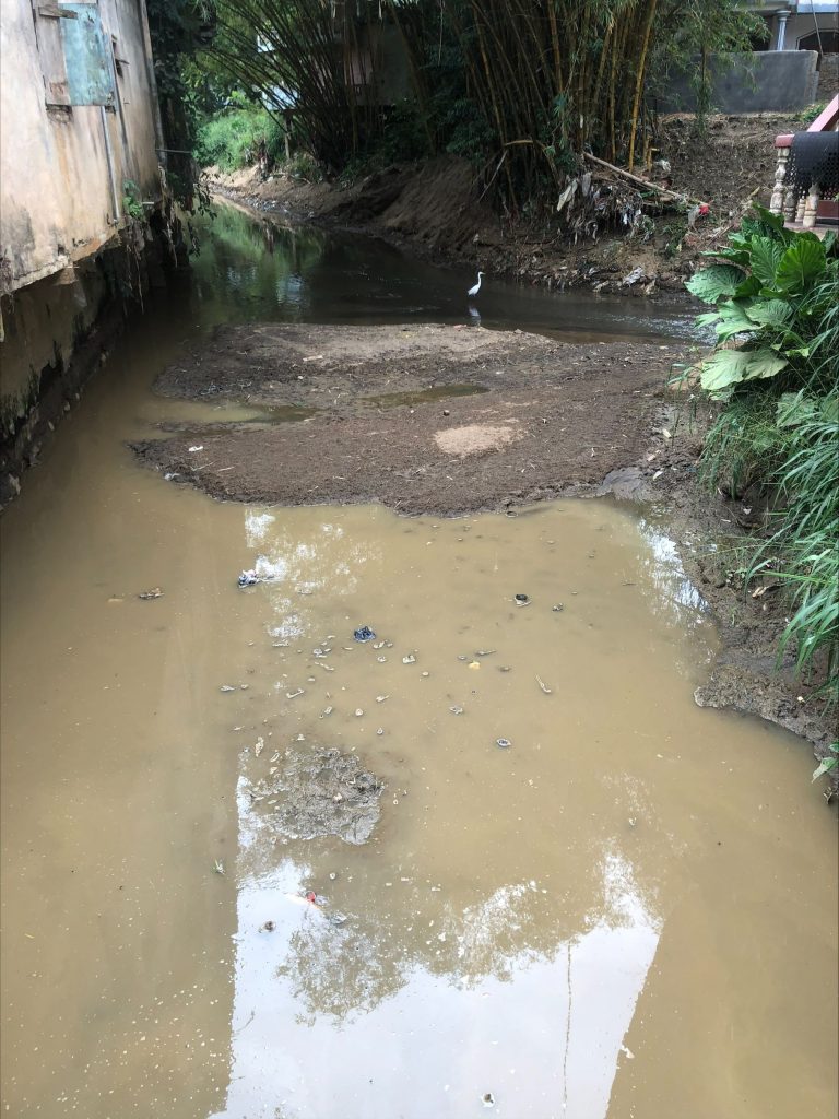
The Wahagalla Oya and Kurugoda Oya Convergence

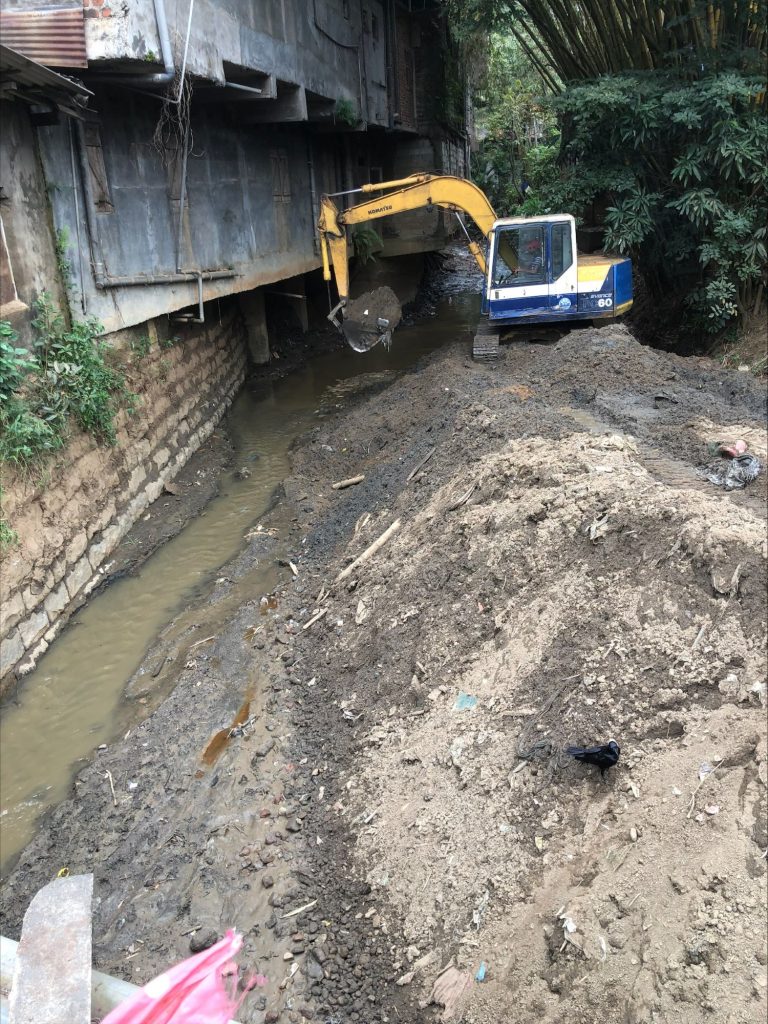
The Wahagalla Oya and Kurugoda Oya Convergence

These pictures are taken from the bridge over Dunuwilla Road. We should think about the river and observe the things that folks do not pay attention to. You can see the,

1. There is still natural vegetation on the Wahagalla Oya side – despite the Bulldozer messing up the river – there is still vegetation – Bamboo Groves in the heart of Akurana.

2. The old dressed stone wall on the left side of the river has been built over and the building extends with a cantilever into the river – more on the second floor – this cuts off the sunlight needed for life on the river.

3. The convergence of the river brings with it seasonal variation in silt deposits – here you can look at the main branch of the river in the first photo and see islands of silt that change from one rain event to the next.

4. See that across the road, you have a bamboo grove and there is still hope for the river.

5. Finally, here too there is a bird – that is surviving but in many ways, the toxins are really hurting the aquatic life.

River convergence

This is where Wahagalla Oya unites with Kurugoda Oya, and it flows downstream to join Pinga Oya. The water from the Wahagalla Oya is muddy, while the water in the Kurugoda Oya is clear.

A cross-section between the bridge and the riverbed

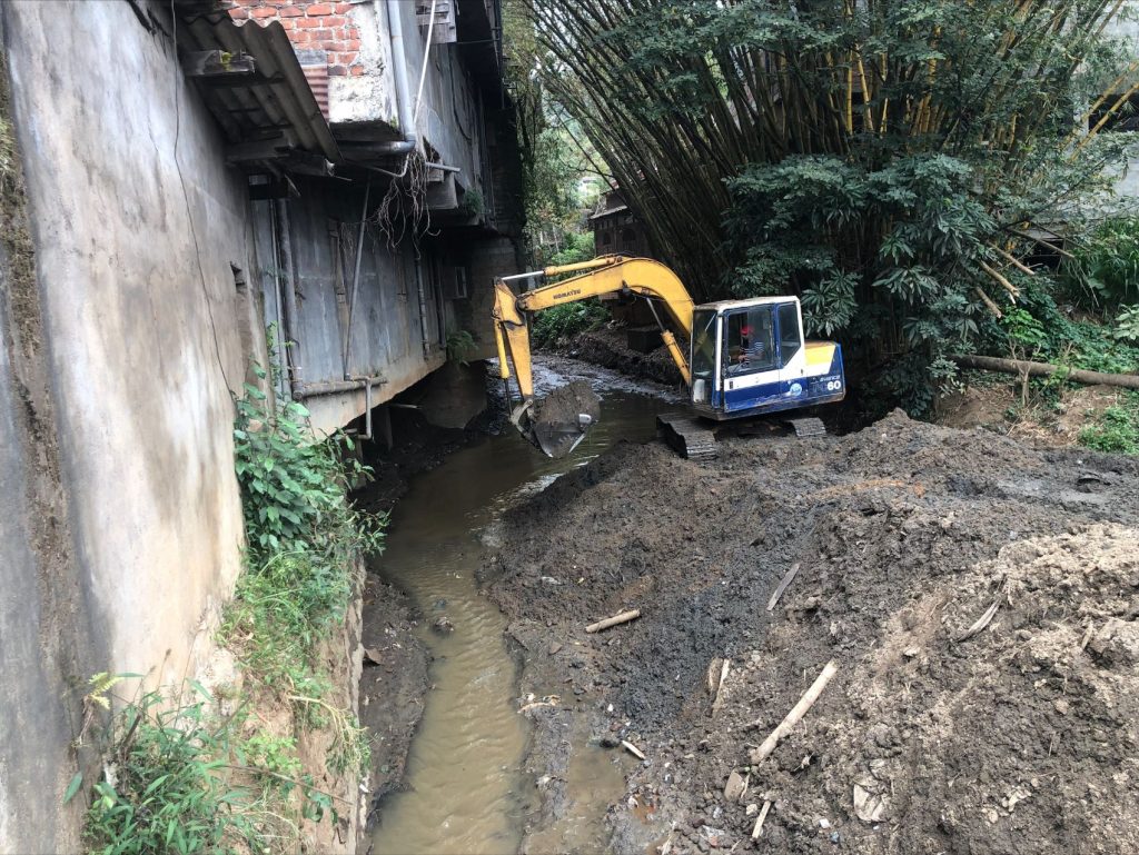
The floods in Akurana begin here. Level of the road is 449.85 m (Mean Sea Level). Cross-section between the bridge and the river bed is narrow because of the construction there, and also shallow because of the silt formation. After heavy rains there is insufficient cross-sectional area for water flow, since water from two rivers meets here.

Silt removal

A backhoe has been used to remove some of the silt and store it on the river bank. Some of the silt has been taken away by tipper trucks.

Following floods, attempts are made over and again to solve the problem by removing silt but nothing else. Such actions provide temporary aspects as silt build up over time, and then the flood returns.

Surrounding area

There is an old trestle stone retaining wall on the right side of the river. And a cantilevered building that has been built into the river by about 3 feet. This building is obstructing the sunlight from reaching the river. The Thakkiya mosque is located on the river’s left bank.

There is some remaining vegetation and a grove of bamboo trees on the left side of the river, which helps to maintain the natural setting

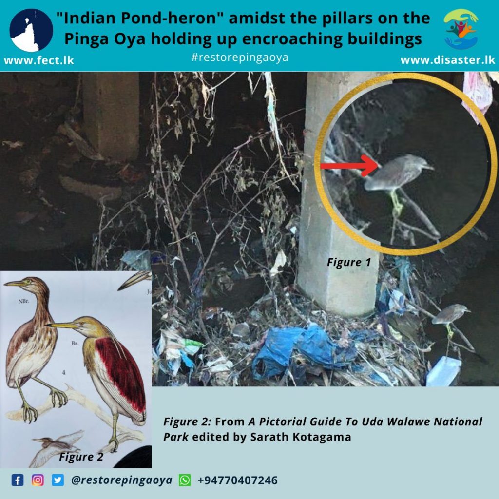
Birdlife under the building encroaching on Pinga Oya

Birdlife under the building encroaching on Pinga Oya near the Mangoose-watte bridge

කන කොකා/குளத்துக் கொக்கு (Ardeola grayii)

Since there was a bird looking at the wasteland underneath the concrete building on stilts occupied the Ceramics and Bathware shop over the Pinga Oya near the so-called Mangoosewatte bridge initially identified as Pond-heron by @riyazifarook, we looked up an ornithological reference by Prof. Sarath Kotagama, Pruthiviraj Fernando, Kelum Gunasekara and Gamini Ratnavira (2014) it confirms that this identification holds – and more specifically, it is the “Indian Pond-heron” (කන කොකා (Ardeola grayii).  

කන කොකා [Kana Koka]/Indian Pond-heron (Ardeola grayii) is a small heron. Usually found in paddy fields throughout the island. It also lives close to tanks, lagoons and marshlands. It is also found in highly urbanized and populated areas. 

Average length is 46cm, Ashy-brown or purplish brown, upper back. Bill and legs yellow green. Appears with a short neck in summer, adults have long neck feathers. Its appearance is transformed from their dull colours when they take to flight. Its legs change colour in the breeding season, turning from green to bright yellow during the months of March to September. Some individuals even have red legs. Most of the time the Indian Pond-heron is very quiet, but it can omit a harsh croak. The Indian Pond-heron’s voice is very similar to a human voice.

Sources: 

1. A Pictorial Guide to Uda Walawe National Park, Edited by Sarath Kotagama (Publication year – 2014)

2. Neeri Biodiversity Portal – https://neeriathome.neeri.res.in/biodiversity/PondHeron.php

Verified by MonsterInsights